![Item #CL173-61 [Meiji Period Traveller’s Map Of Japan]](https://joseflebovicgallery.cdn.bibliopolis.com/pictures/CL173-61_1.jpg?width=768&height=1000&fit=bounds&auto=webp&v=1492652022)
![[Meiji Period Traveller’s Map Of Japan]](https://joseflebovicgallery.cdn.bibliopolis.com/pictures/CL173-61_2.jpg?auto=webp&v=1492652022)
![[Meiji Period Traveller’s Map Of Japan]](https://joseflebovicgallery.cdn.bibliopolis.com/pictures/CL173-61_3.jpg?auto=webp&v=1492652022)
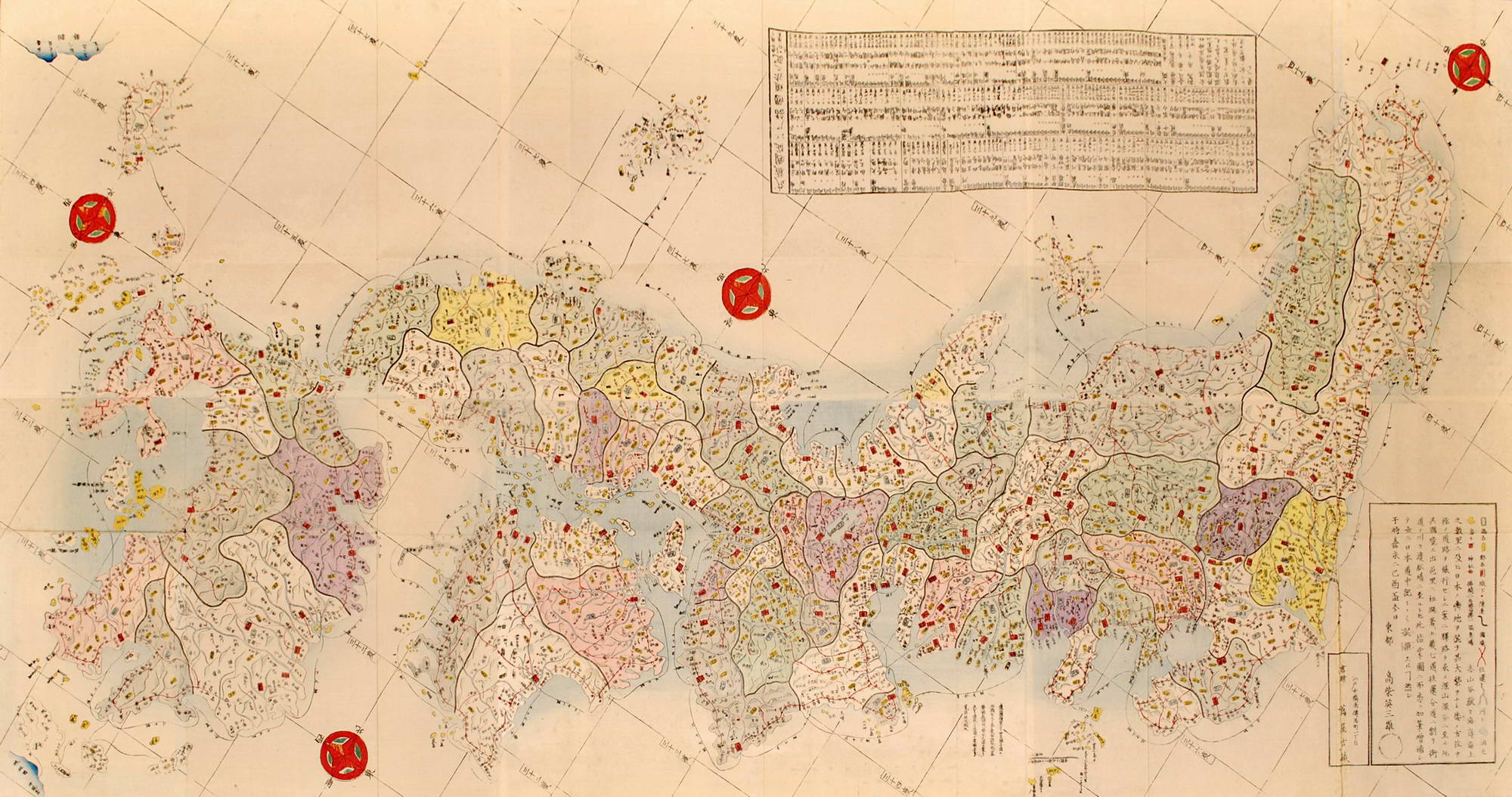
[Meiji Period Traveller’s Map Of Japan]
c1860s. Colour woodcut map comprising six sheets, in original paper wrappers, title and text in Japanese, 71.4 x 143.7cm (overall), 24 x 18.2cm (folded). Slight soiling and wear overall, some foxing and creases to wrappers. Text includes a key to distances of towns from Tokyo, and services available to a traveller at each location. The map does not show Hokkaido. The lines of latitude and longitude on the map are a concept adopted from the West, suggesting it was made after Japan established foreign relations with the USA in the mid-1850s. It is not likely that Japan would have been depicted as a whole country on a map, until it was unified under the rule of Emperor Meiji after the Meiji Revolution in 1868.
Item #CL173-61
Please contact us re availability other currencies