![Item #CL198-167 Plan Of Littles Wharf, Dowling Street, Wooloomooloo [Sic] Bay [NSW]](https://joseflebovicgallery.cdn.bibliopolis.com/pictures/CL198-167.jpg?width=768&height=1000&fit=bounds&auto=webp&v=1576814708)
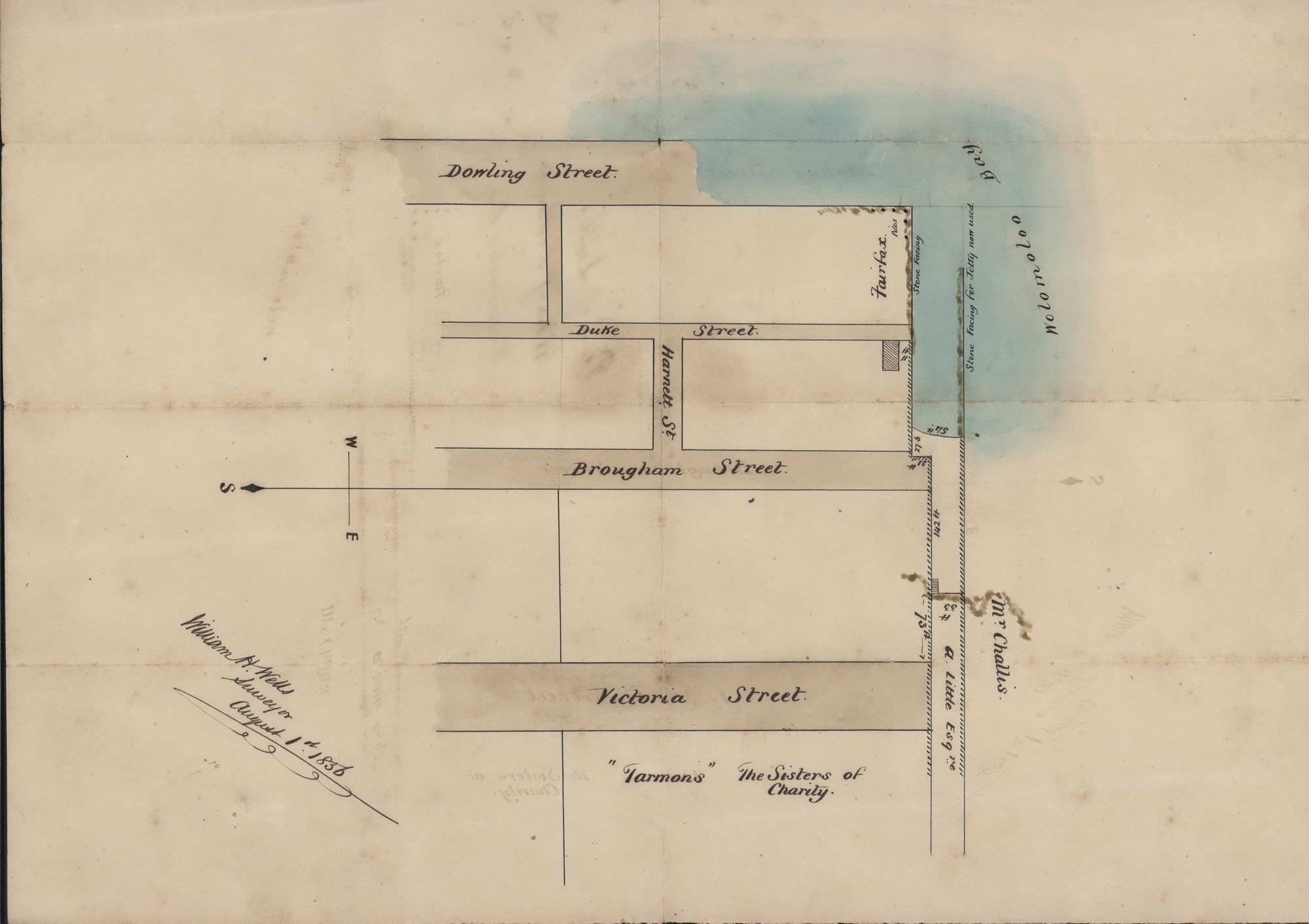
Plan Of Littles Wharf, Dowling Street, Wooloomooloo [Sic] Bay [NSW]
1856. Ink and watercolour on paper, dated “August 1st, 1856” and inscribed “William H. Wells, surveyor” in ink lower left, titled in ink verso, 43.3 x 34cm. Old folds. This map shows the early streets around Woolloomooloo in Sydney: Dowling, Duke, Brougham and Victoria Streets. Also notes the site of “Tarmons: the Sisters of Charity” building, the properties of “Fairfax”, “A. Little Esq.” and “Mr Charles”, and shows “Wolomoloo [sic] Bay.” Provenance: Daniel Cooper estate. Daniel Cooper (1785–1853) was a pardoned convict who amassed a fortune in the 1820s through real estate and various business interests including whaling, sealing, shipping, and the export of Australian wool, mostly through the trading firm known as Cooper and Levey’s. The firm acquired John Piper’s estate when it was sold, comprising over 1100 acres at Woollahra and Rose Bay; Cooper also owned parts of Liverpool. He later became involved in the banking business, becoming a governor of the Bank of NSW in 1828. Ref: ADB.
Item #CL198-167
Price (AUD): $1,950.00 other currencies