![Item #CL198-171 Cooper To Giles Map [Woollahra, NSW]](https://joseflebovicgallery.cdn.bibliopolis.com/pictures/CL198-171.jpg?width=768&height=1000&fit=bounds&auto=webp&v=1576814708)
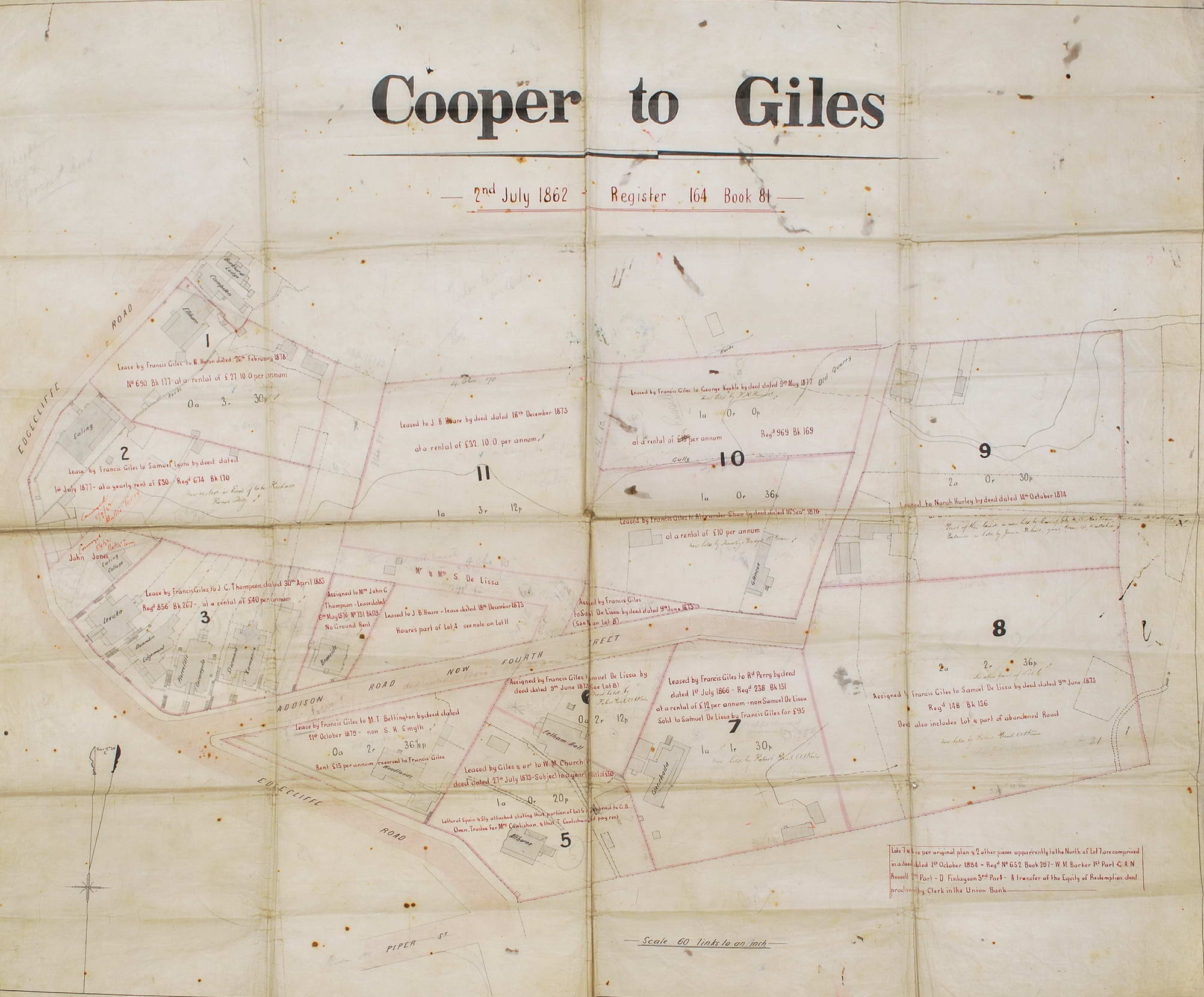
Cooper To Giles Map [Woollahra, NSW]
1862–1883. Black and red ink on linen, dated “2nd July 1862” and annotated with lease holders up to 1883 in ink throughout, 85 x 103cm. Old folds, stains. Map noting land leases and important houses running along Edgecliffe [sic] Road, Addison Street (now Wallaroy Road), and Piper Street (now Queen street). Provenance: Daniel Cooper estate. Houses shown include Althorne, Braeside, Burkhardt Lodge, Campden, Carangula, Ealing, Edgemont, Eltham, Glencoe, Glenrhoda, Levuka, Pelham Hall, Pierrefitte, Stormont, Woodlands, and Xamonia. Daniel Cooper (1785–1853) was a pardoned convict who amassed a fortune in the 1820s through real estate and various business interests including whaling, sealing, shipping, and the export of Australian wool, mostly through the trading firm known as Cooper and Levey’s. The firm acquired John Piper’s estate when it was sold, comprising over 1100 acres at Woollahra and Rose Bay; Cooper also owned parts of Liverpool. He later became involved in the banking business, becoming a governor of the Bank of NSW in 1828. Ref: ADB.
Item #CL198-171
Price (AUD): $5,500.00 other currencies