![Item #CL198-179 Plan Showing Alternate Roads, Macquarie Mountain [South Coast, NSW]](https://joseflebovicgallery.cdn.bibliopolis.com/pictures/CL198-179.jpg?width=768&height=1000&fit=bounds&auto=webp&v=1576814708)
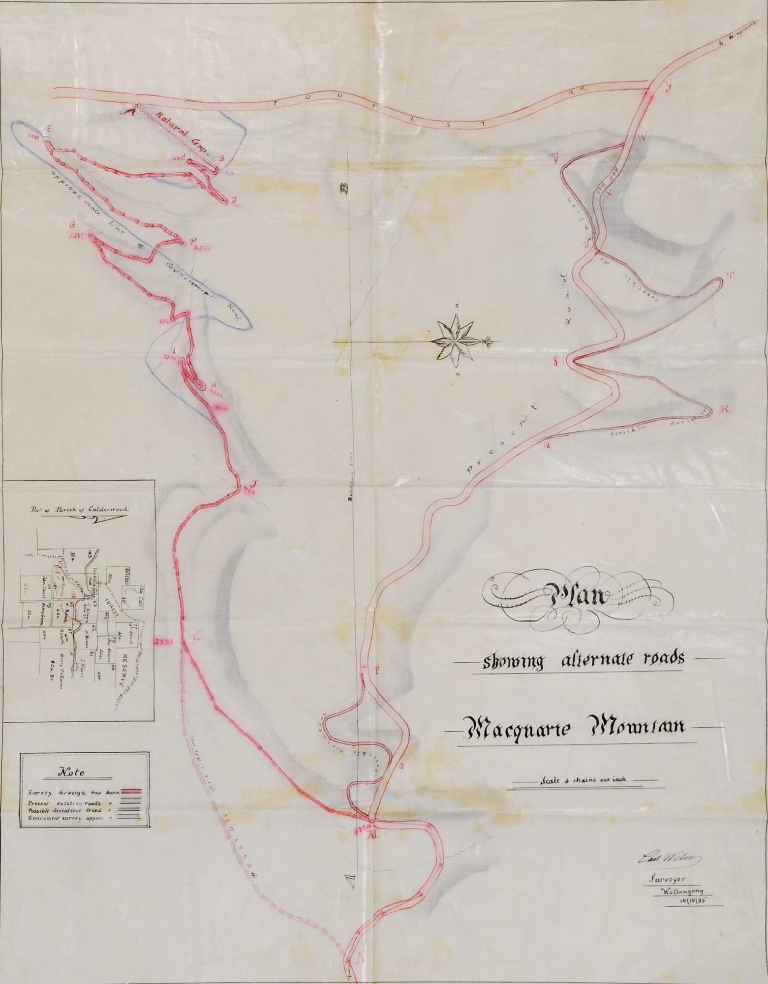
Plan Showing Alternate Roads, Macquarie Mountain [South Coast, NSW]
1895. Black and red ink and watercolour on linen, titled, annotated and dated “Carl Weber, Surveyor, Wollongong 10/10/95” in ink lower right, 51 x 43.3cm. Old folds, slight stains. Insert of a small map details “Part of Parish of Calderwood” with landowners: J. Brown, John Carrell, Henry Green, J. Moore, Henry Osborne and W. Roach. Provenance: Daniel Cooper estate. This map is a survey through Macquarie Pass, the 8km winding road up the Illawarra Escarpment. “The necessity for opening road communication between Albion Park [Shellharbour region] and the ‘rich agricultural lands of Wingecarribbee [Southern Highlands region]’…was felt as early as the 1860s.” In August 1887, Minister for Works John Sutherland promised to have a survey of the “Macquarie Pass locality” done to find the best route over the mountain. Carl Weber (1853–1923) surveyed the upper portion of the Macquarie Pass, and the road was opened in 1898. Ref: Wiki; Illawarra Mercury, 13.9.2013; University of Wollongong. Daniel Cooper (1785–1853) was a pardoned convict who amassed a fortune in the 1820s through real estate and various business interests including whaling, sealing, shipping, and the export of Australian wool, mostly through the trading firm known as Cooper and Levey’s. The firm acquired John Piper’s estate when it was sold, comprising over 1100 acres at Woollahra and Rose Bay; Cooper also owned parts of Liverpool. He later became involved in the banking business, becoming a governor of the Bank of NSW in 1828. Ref: ADB.
Item #CL198-179
Price (AUD): $3,300.00 other currencies