![Item #CL199-8 Carte Des Decouvertes Du Captain Carteret Dans La Nouvelle Bretagne [New Britain & New Guinea]](https://joseflebovicgallery.cdn.bibliopolis.com/pictures/CL199-8.jpg?width=768&height=1000&fit=bounds&auto=webp&v=1585631490)
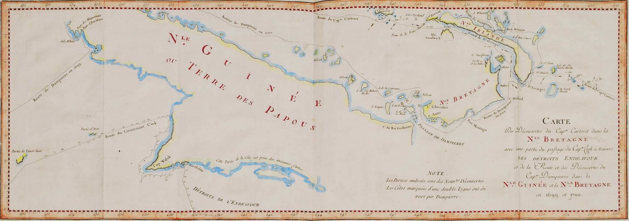
Carte Des Decouvertes Du Captain Carteret Dans La Nouvelle Bretagne [New Britain & New Guinea]
c1775–1780. Hand-coloured engraving, text in French, 23.8 x 63.1cm. Trimmed upper platemark, minor creases, stains. Text continues “avec une partie du passage du Cap’ne Cook a travers Les Detroits Endeavour et de la route et des decouvertes du Cap’ne Dampierre dans la N’le Guinee at le N’la Bretagne en 1699 et 1700. Note: Les parties ombrees sont des Nouv’les decouvertes. Les cotes marquees d’une double ligne ont ete vues par Dampierre. Tome I, pl. 13.” [This is a map of Captain Carteret’s discoveries in New Britain with part of the Captain Cook passage through the Endeavor Straits, and the route and discoveries of Captain Dampier in New Guinea and New Britain in 1699 and 1700. Note: The shaded parts are new discoveries. The coasts marked with a double line were seen by Dampierre.] This map shows the sea-tracks of three explorers: Philip Carteret’s voyage of 1766 to 1769 aboard the HMS Swallow; the voyage of William Dampier who named New Britain, an island in Papua New Guinea, in 1700; and Captain Cook’s first Pacific voyage from New Holland to Batavia in 1770. Ref: NLA.
Item #CL199-8
Please contact us re availability other currencies