Go Back
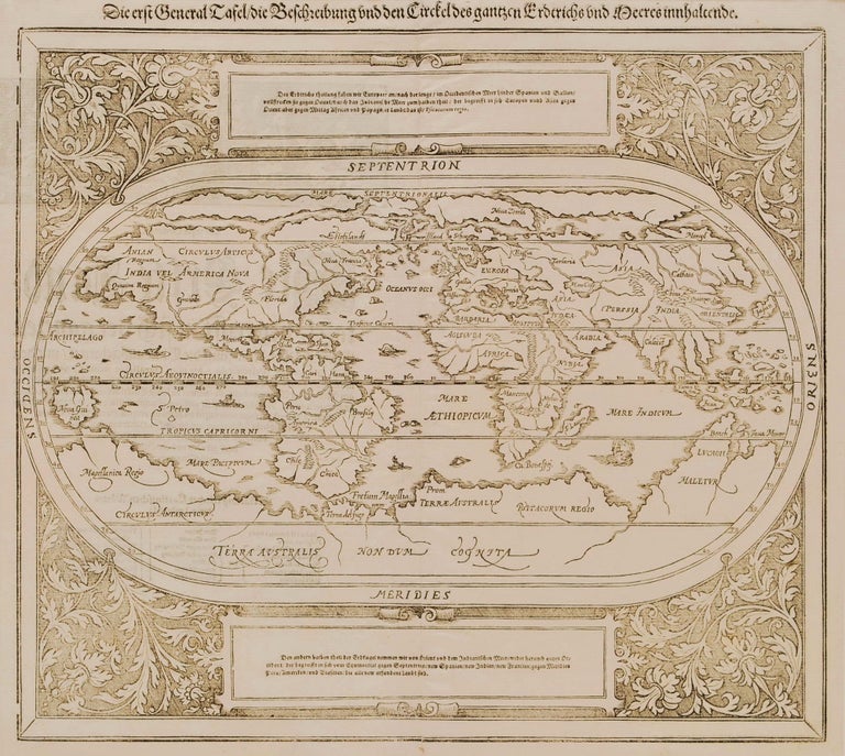
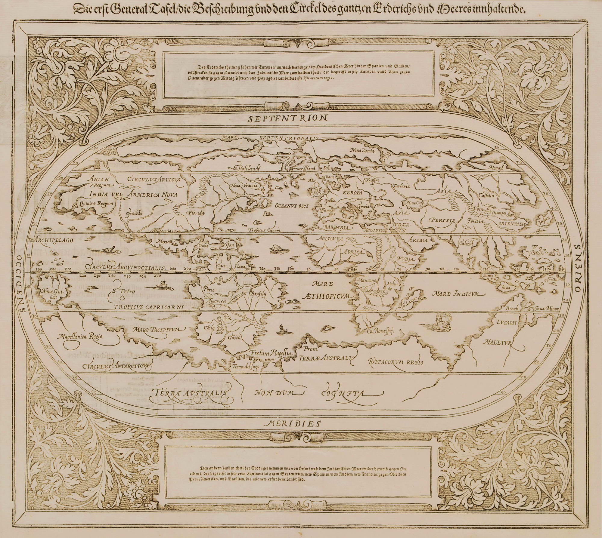
First General Map Of The World, Showing Unknown “Terra Australis”
c1588. Wood engraving, 32.3 x 35.9cm. Minor foxing, old folds and creases, chips and repaired tears to edges. Text loosely translated from German includes “The first general chart showing the sphere of the Earth.” The map shows “Terra Australis non dum cognita [not yet known]”, which includes parts of the coastlines of Antarctica and Australia. This map was completely redrawn and re-engraved for the 1588 edition of Sebastian Münster’s Cosmographia, and all subsequent editions up to 1628, published in Basle, Switzerland by Sebastian Petri [?]. Münster was not directly connected with this map, which is based on the world maps by A. Ortelius of 1570. Ref: Shirley #163.
Item #CL181-1
Price on Application
See all items in
Prints