![Item #CL198-168 Plan Of Road From Dapto [Creek] To NW Corner Of W.F. Weston’s 500 Acres [NSW]](https://joseflebovicgallery.cdn.bibliopolis.com/pictures/CL198-168.jpg?width=768&height=1000&fit=bounds&auto=webp&v=1576814708)
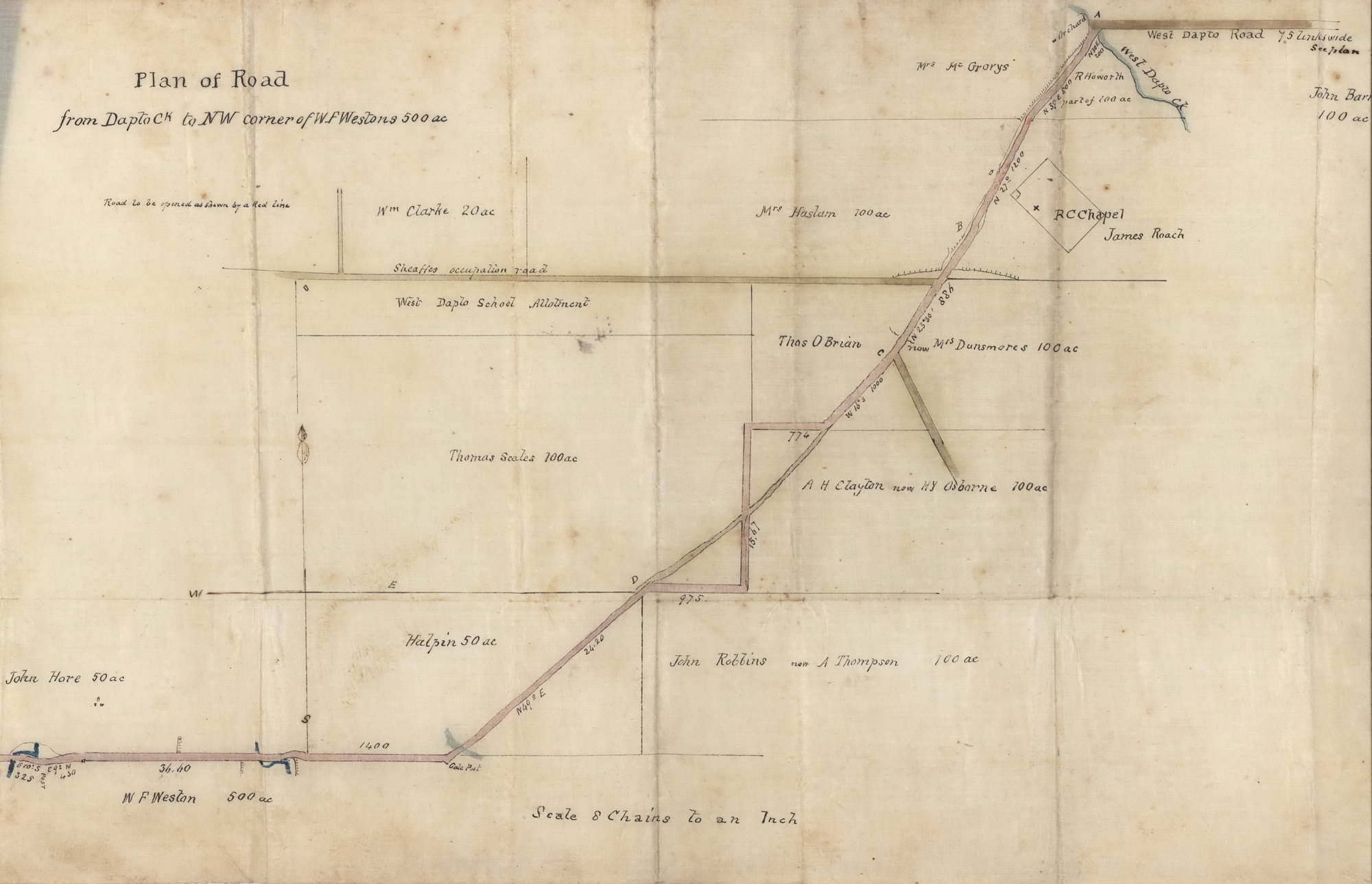
Plan Of Road From Dapto [Creek] To NW Corner Of W.F. Weston’s 500 Acres [NSW]
c1850–1860s. Ink and watercolour on linen, titled in ink upper left, 28 x 50.5cm. Old folds, stains. Shows West Dapto Road “to be opened as shown by a red line.” Provenance: Daniel Cooper estate. William Frances Weston’s 500 acres in Dapto, bordered on the north by West Dapto Road, were granted in 1818 by Governor Macquarie as a “promise grant” to Weston, one of the first free settlers in the Illawarra. The farm eventually became a village, with 84 tenants in 21 slab houses. The promise grant was ratified in 1842 by Governor Gipps, and a house was built by William Weston’s daughter Elizabeth and her husband Andrew Thompson. Having changed hands and names several times and undergone some additions, it became known as Horsley Homestead. The property, including the outbuildings associated with dairy farming, remains “significantly intact.” Ref: Wiki. Daniel Cooper (1785–1853) was a pardoned convict who amassed a fortune in the 1820s through real estate and various business interests including whaling, sealing, shipping, and the export of Australian wool, mostly through the trading firm known as Cooper and Levey’s. The firm acquired John Piper’s estate when it was sold, comprising over 1100 acres at Woollahra and Rose Bay; Cooper also owned parts of Liverpool. He later became involved in the banking business, becoming a governor of the Bank of NSW in 1828. Ref: ADB.
Item #CL198-168
Price (AUD): $2,200.00 other currencies