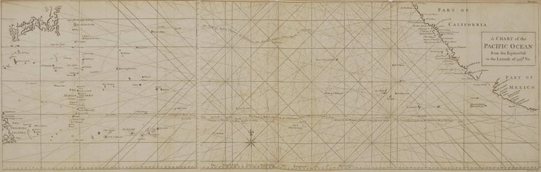
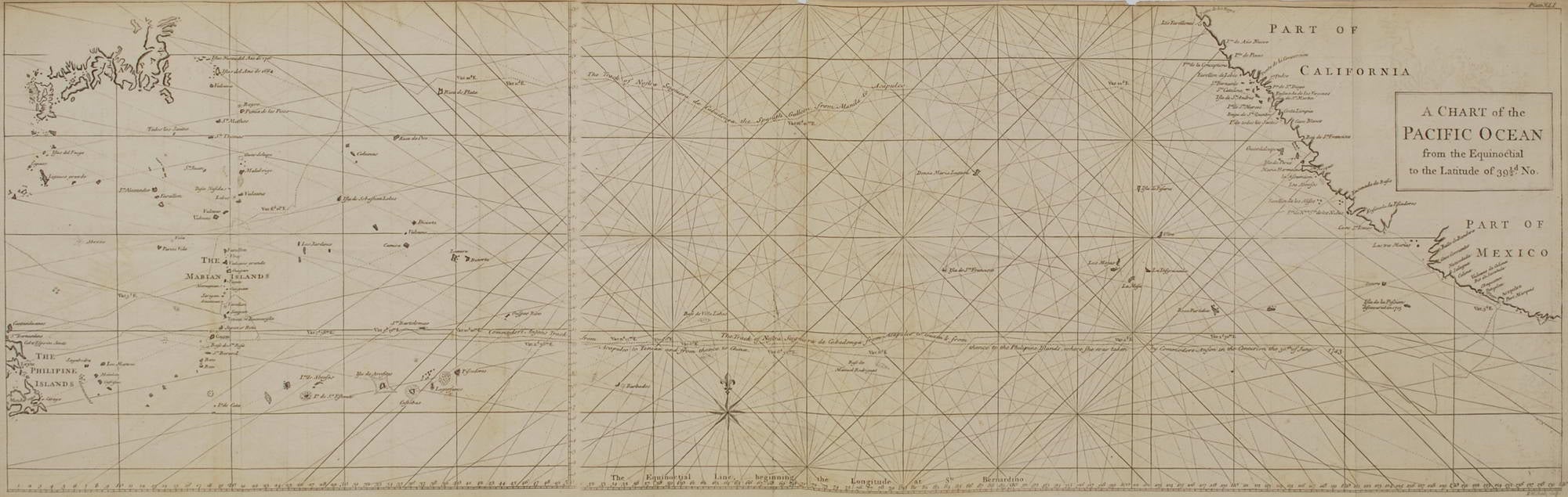
A Chart Of The Pacific Ocean From The Equinoctial To The Latitude Of 39 ½d. No.
c1744. Engraving in two sheets, plate number “XLI” and title upper right in image, and engraver “Richard William Seale” in platemark below image, 27.7 x 90cm. Old folds, minor tears and stains to edges, trimmed upper margin. Text includes “Commodore Anson’s track from Acapulco to Tenian and from thence to China. The track of Nosta Seigniora de Cabadonga from Acapulco to Guam & from thence to the Philipine [sic] Islands, where she was taken by Commodore Anson in the Centurion the 30th of June 1743.” This map is from A Voyage Round the World, in the Years MDCCXL, I, II, III, IV, by George Anson, Esq., Commander in chief of a squadron of His Majesty’s ships sent upon an expedition to the South-seas, 1748. Held in NLA; Royal Museums Greenwich. This large sea chart of the Pacific details the “route of the Spanish treasure galleons between the Philippines and Acapulco. The coasts of California, Mexico, Japan, the Philippines, and the Mariana Islands are outlined in hand colour. A decorative compass rose at bottom centre marks north, and the chart is crisscrossed with rhumb lines [an imaginary line on the earth’s surface cutting all meridians at the same angle, used as the standard method of plotting a ship’s course on a chart]. The routes taken by the Spanish galleon Nuestra Senora de Covadonga in 1743 are shown, along with the path of HMS Centurion, commanded by Admiral George Anson. Anson’s capture of the Manilla galleon was one of the most significant moments in eighteenth century British navigation, adding significantly to British geographic knowledge of the Pacific owing to the seizure of Spanish navigational charts amongst the cargo and prize money of the Nuestra Senora de Covadonga.” Ref: Sanders of Oxford.
Item #CL199-5
Price (AUD): $880.00 other currencies