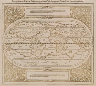
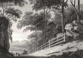
First General Map Of The World, Showing Unknown “Terra Australis”
c1588. Wood engraving, 32.3 x 35.9cm. Minor foxing, old folds and creases, chips and repaired tears to edges. Text loosely translated from German includes “The first general chart showing the sphere of the Earth.” The map shows “Terra Australis non dum cognita [not yet known]”, which includes parts of the..... More
![Item #CL174-1 Indiae Orientalis, Nova Descriptio [Dutch Map Of The East Indies]. Johannes...](https://joseflebovicgallery.cdn.bibliopolis.com/pictures/CL174-1.jpg?width=320&height=427&fit=bounds&auto=webp&v=1492653601)
![Item #CL181-5 [Australian Sea Shells]. R P. Nodder, British](https://joseflebovicgallery.cdn.bibliopolis.com/pictures/CL181-5_1.jpg?width=320&height=427&fit=bounds&auto=webp&v=1486012424)
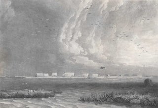
![Item #CL202-4 Pinchgut Island [Fort Denison, Sydney Harbour]. Vincent Woodthorpe,...](https://joseflebovicgallery.cdn.bibliopolis.com/pictures/CL202-4.jpg?width=320&height=427&fit=bounds&auto=webp&v=1619759837)
![Item #CL174-5 Nouvelle Hollande: Nouvelle Galles Du Sud [Brown And Red Platypus, NSW]....](https://joseflebovicgallery.cdn.bibliopolis.com/pictures/CL174-5.jpg?width=320&height=427&fit=bounds&auto=webp&v=1492653601)

![Item #CL174-7 View Of Captain Piper’s Naval Villa, At Eliza Point, Near Sidney [sic], New...](https://joseflebovicgallery.cdn.bibliopolis.com/pictures/CL174-7.jpg?width=320&height=427&fit=bounds&auto=webp&v=1492653601)